 >
>
 >
>
 >
>
 >
>
 >
>
Zbirka: Avtokarte in cestni atlasi
214 rezultatov
-
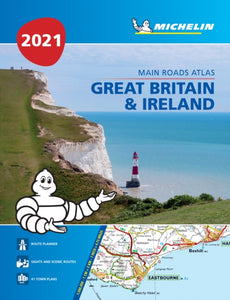 Great Britain & Ireland 2021 - Mains Roads Atlas (A4-Paperback)(2020) MICHELINMichelin Tourist and Motoring Atlases are the perferct travel companions for holiday planning and everyday journeys. In addition to clear and accurate mapping, the Michelin motoring altas series will help you optimise and add comfort to your journey. In s11,93 €
MICHELIN
Great Britain & Ireland 2021 - Mains Roads Atlas (A4-Paperback)
Michelin Tourist and Motoring Atlases are the perferct travel companions for holiday planning and everyday journeys. In addition to clear and accurate mapping, the Michelin motoring altas series will help you optimise and add comfort to your journey. In s
Zaloga po trgovinah
Rezultati:
-
 Central Europe Road Map 1:2 000 000(2017)freytag & berndt maps are available for many countries and regions in the world. In addition to the precise cartography each map also includes a lot of additional information about the region covered.19,27 €
Central Europe Road Map 1:2 000 000
freytag & berndt maps are available for many countries and regions in the world. In addition to the precise cartography each map also includes a lot of additional information about the region covered.
Zaloga po trgovinah
Rezultati:
-

-

-
-
-

-
 50 Miles around Bristol A-Z Road Map(2018) A-Z MAPSThis A-Z 50 Miles around Bristol map is a full colour, single sided, fold-out road map featuring continuous mapping extending to include Worcester and Stratford-upon-Avon to the north, Witney and Andover to the east, Bournemouth and Lyme Regis to the sout8,27 €
A-Z MAPS
50 Miles around Bristol A-Z Road Map
This A-Z 50 Miles around Bristol map is a full colour, single sided, fold-out road map featuring continuous mapping extending to include Worcester and Stratford-upon-Avon to the north, Witney and Andover to the east, Bournemouth and Lyme Regis to the sout
Zaloga po trgovinah
Rezultati:
-
 Philip's Handy Road Atlas France, Belgium and The Netherlands(2021) PHILIP'S MAPSPhilip's Handy Road Atlas of France, Belgium and The Netherlands features new digital cartography from Philip's - voted Britain's clearest and most detailed European mapping in an independent consumer survey. This compact A5 atlas with lie-flat binding i9,72 €
PHILIP'S MAPS
Philip's Handy Road Atlas France, Belgium and The Netherlands
Philip's Handy Road Atlas of France, Belgium and The Netherlands features new digital cartography from Philip's - voted Britain's clearest and most detailed European mapping in an independent consumer survey. This compact A5 atlas with lie-flat binding i
Zaloga po trgovinah
Rezultati:
-
 2023 Philip's Easy to Read Multiscale Road Atlas Europe(2022) PHILIP'S MAPS22,22 €
PHILIP'S MAPS
2023 Philip's Easy to Read Multiscale Road Atlas Europe
Zaloga po trgovinah
Rezultati:
-

-

-

-

-
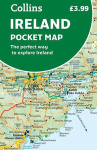 Ireland Pocket Map(2022) COLLINS MAPSExplore Ireland with this handy, full colour map. Handy little full colour map of Ireland at an excellent price. It is double-sided, with the south of Ireland up to and including Dublin on one side, and from Dublin northwards on the5,55 €
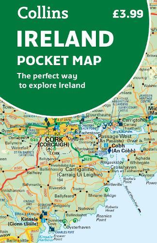
COLLINS MAPS
Ireland Pocket Map
Explore Ireland with this handy, full colour map. Handy little full colour map of Ireland at an excellent price. It is double-sided, with the south of Ireland up to and including Dublin on one side, and from Dublin northwards on the
Zaloga po trgovinah
Rezultati:
-
-
 Collins Map of Europe(2022) COLLINS MAPSDiscover new places with handy maps from Collins. A fully revised and updated colour road map of Europe at a scale of 79 miles to 1 inch / 50km to 1cm (1: 5,000,000). Roads, motorways, European Route numbers, railways, airports, citi9,72 €
COLLINS MAPS
Collins Map of Europe
Discover new places with handy maps from Collins. A fully revised and updated colour road map of Europe at a scale of 79 miles to 1 inch / 50km to 1cm (1: 5,000,000). Roads, motorways, European Route numbers, railways, airports, citi
Zaloga po trgovinah
Rezultati:
-
 Collins Essential Road Atlas Europe(2022) COLLINS MAPSDiscover new places with handy road atlases from Collins. Up-to-date A4 paperback road atlas of Europe. Contains clear, large-scale, detailed road mapping, perfect for touring the Mediterranean, Iberian peninsula, Scandinavia and all European tourist de20,83 €
COLLINS MAPS
Collins Essential Road Atlas Europe
Discover new places with handy road atlases from Collins. Up-to-date A4 paperback road atlas of Europe. Contains clear, large-scale, detailed road mapping, perfect for touring the Mediterranean, Iberian peninsula, Scandinavia and all European tourist de
Zaloga po trgovinah
Rezultati:
-
 Easy Read Atlas Britain 2023(2022)A4 format revised and updated for 2023, including 6 page clear Route Planner map. Providing giant scale mapping, at 2.3 miles to 1 inch. Features include large print place names and index, top 300 AA-inspected caravan and camping sites, over 240 service23,61 €
Easy Read Atlas Britain 2023
A4 format revised and updated for 2023, including 6 page clear Route Planner map. Providing giant scale mapping, at 2.3 miles to 1 inch. Features include large print place names and index, top 300 AA-inspected caravan and camping sites, over 240 service
Zaloga po trgovinah
Rezultati:
-


 >
>
 >
>
 >
>
 >
>
 >
>


